Tuesday, March 26, 2013

London Travel Guides - What I Use to Plan


Last week I told you about some London Travel apps that I was trying out for my upcoming trip (only 6 months away!).  Well, as much as I love an app I am still an old school travel book kind of girl.

Travel books are my favorite kind of book. I love looking at the maps, pictures, restaurant recommendations. It doesn’t take much to make me excited to travel. Now everyone has their favorite place in the world – and goodness knows I have plenty. I have truly never hated anywhere I have traveled to – and I think that is because I like to do so much research. London is my ultimate destination – if I could travel there every year I would. So even though it is a huge city – I somewhat have a handle on what to see or do, but that doesn’t mean I know it all. Goodness I don’t think anyone could know everything there is to do in such an eclectic city!

With that point tucked in the back of my mind I tried to be as diverse as I could when it came time to make my London travel book purchases. Right now I have 3 London specific books, 1 for the Cotswolds, and 1 for travel in general.


The book I am enjoying the most is London Style Guide by Saska Graville.


The author assumes you know what the big tourist attractions are in London and therefore breaks the city down further by neighborhood. I really love this as this is my third time in London, and I want to zone in on some specific neighborhoods and get to know them better.  As you can see I have flagged a lot of pages!


I found the Cool London book in a little specialty shop in Savannah, GA.


This is a cute little book to look at, but out of 182 pages I only flagged 4 places –still a neat way to pass time before drifting off to bed and dreaming about London.

The first travel guide for London I bought was the DK London guide – the Millennium version! 


Ha! Over ten years old, but I will never let it go. It was my first. I love looking through it and seeing what I have flagged. I can always go back and revisit that place. Or try a new place that I didn’t research the time before. And always DK has some nice walking routes that I like to build upon.


For the Cotswold portion of the trip I bought the Cotswolds Rough Guide.


This little book is a gem in my opinion. It has so much information – which I feverishly digest. Then once I have a plan in place - like which villages to visit and what pubs to try – I find even more information in the book that causes me to re-work the plan! That is a good problem to have!


And finally there is the 1,000 Places To See Before You Die


I am slowly checking off places inside the pages. I am 100% sure I won’t get to everything, but it has been fun trying! It is always interesting to look up a place that you will be visiting and see what is or is not on the author’s list.

What about you? Do you have a favorite travel book or guide? How much do you prepare for a trip? A little? Or a lot?


Wednesday, March 20, 2013

London Travel Apps


I went a little app crazy (that is what happens when you receive iTunes gift cards)! I love travel apps, and I always download a good chunk of them to try out before traveling. I especially like to look for apps that can be used offline as you never know where you will receive decent Wi-Fi and who wants to pay roaming charges?

As always I start with Trip Advisor and Yelp apps when researching. I like the bookmark feature on Yelp so I can tag restaurants that look interesting and then research them later. I also always make sure my Wi-Fi Finder app is always up to date!

And Trip Advisor is a good tool, but I always take the reviews with a grain of salt. I do use the TA website more than the app – I’m not really feeling the app.

For the London portion of the trip I found these apps and am anxiously trying them out! 

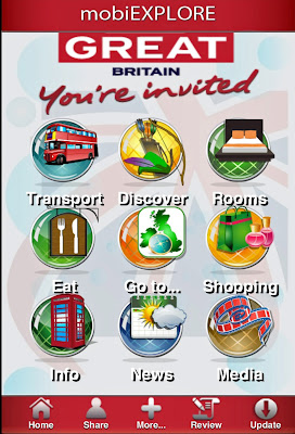
mobiExplore GreatBritain:


A good general overview of Britain - along with the usual transport and hotel options it even explores haunted places, legends, secret Britain and World Heritage sites. I went in to the Discover option and found the Cotswolds. From there the app gave me options from the current weather to Top Trip Advisor attractions.  Good for a general overview.

Free on iTunes.

London Official Guide from www.visitlondon.com


Broken out into: What’s On, Places, Map and Favourites

I really like the theatre listings under What’s On. You can view by map and just touch the pins on the area you are concentrating on for more information. That’s pretty much it. It probably is better used in conjunction with the Visit London website than a standalone app. I will use this to keep an eye on the theatre listing for now.

Free on iTunes.

Ulmon London


I am very excited for this app, and I really hope it lives up to my expectations! Fingers crossed!

This one sold me on the fact that once you download from the iTunes store it can be used completely offline. I have had other apps promise this and then they either don’t work or there is a hidden charge.

Depending on where the map is located you can search, use the Wiki Guide, find nearby, bookmark , and have Face Book or Twitter users follow you and trade recommendations. And there is a Tube/train map!


It did take quite awhile to download so best to do the process from the PC not your device.

Free on iTunes!!

Tube Map

It’s exactly what it says – a tube map. Find a station, plane a trip, and check for delays. And it supports Oyster cards which is what most tourist use when traveling around London. This map is solely for my inner map geek. I love maps. I love the Tube. Even if I am not in London I will be checking and looking at the map. Are the trains on time today? And I even received a notification that HRH The Duchess of Cambridge was at the Baker St Tube stop helping celebrate 150 years of the Underground. This does wonders for my Anglophenia!

Free on iTunes

Riverside London


Search the South Bank, Bank Side and London Bridge areas for absolutely anything. That’s good because I plan on spending a lot of time here! Is the Hayward Gallery sold out today? Maybe I do want to book a ride on the Eye with some champagne? It is a very nice looking app that has an appropriate amount of information and interactive maps (for use when you are there).

Free on iTunes

Vusiem British Museum

This one is for the husband who plans to spend as much time as possible at the British Museum.


Description from iTunes:
We have selected more than 800 objects for you to see at London’s most famous attraction. It is the most comprehensive collection outside the museum’s website. Objects are provided with an image, an exact location on the map, a detailed description, associated search tags and related Wikipedia links. There is no Wi-Fi at the museum. So, everything is preloaded for you and no connection is needed post download. Snazzy!

Free on iTunes

There are a lot more out there, and I had to stop myself! There is even an app to find street art in London. By location, style or artist but at $4.99 I decided against it - even though it sounds really cool!

What about you? Do you use apps? What are your favorites? Any recommendations?


Wednesday, March 6, 2013

A Jet Lagged Vagabond Walk London: Speedy's Cafe to the British Museum

Back in August I posted a walk on the blog that I created called the Jet Lagged Vagabond's Sherlock Walk. The walk is comprised of all the filming locations in London for the BBC One show Sherlock. I saw all the filming information on the Sherlockology website, and then I cobbled together the locations that I thought would make a nice round walk on Google maps.

While I think the Sherlock walk I created is pretty fantastic (and by that I mean it is a walk I would LOVE to take - and I plan on trying it out this September when I am in London). I wasn't really happy with the way the walk looked on the blog. I am not a computer novice, but by no means am I one of these fancy programmers or able to make the GIFS I see on Tumblr that make me smile.

I have a lot of ideas for walks in a lot of places in the world. And I also would like to just sit down with a map and create a walk from scratch incorporating various themes, food, bars, historic locations, gardens -what have you.

So lucky for me I found a mapping class that was offered on the website Skillshare. I am now taking a class called Map Design: Learn to Communicate Places Beautifully, and these are a few things I have learned to embellish my Google Maps! Get ready for a lot of map posts!

I am revisiting my Sherlock walk to make it look better, and I will use this as my final project in the map class. I have taken a segment of the original walk - Speedy's Cafe to Russell Square and tacked on the British Museum at the end as this is a walk I would like to take when I am in London.

So the first thing I have learned is to embed a Google map into the blog- Huzzah!


View Walking directions from Speedy's to British Museum, London in a larger map


Here in the second attempt I added some icons.


View Speedy's Cafe to the British Museum in a larger map

On the map above I drew the lines myself (letting me plot whatever route I wanted to take) and added in the icons. Oh this is going to be fun!

Now I have learned how to take the Google map into Photoshop Elements and trace over it to make a drawing. Okay so it is not perfect. It may even look like a five year old doodled this, but it can only get better! I think with a little practice I will get going on a style I really like, and I hope to make some of these maps for my upcoming London trip! So now - on to the the final map class project and some practice time!